Mary River
Giant Boab Tree
Gregory’s Tree

Gregory National Park

It was time to say goodbye to Northern Territory after 2 weeks of being here. It has been a wonderful experience. But before crossing to Western Australia, I had one more place that I wanted to go, Gregory National Park.

I arrived Gregory N.P. just before noon and it was 32 and not a cloud in the sky. It felt more like 40. Tried to do this Escarpment Walk but the sun was just too much. I had to give up after a km up the hill. I did manage to get a few shots of the Mary River below and Davenport Ranges.

Next in my list was Gregory’s Tree. A base camp for Augustus Charles Gregory’ exploration in 1856. He left an inscription on a large boab tree on 2nd July, 1856, indicating where he left a letter in case the expedition team should get lost. I wonder how old the tree actually is…

Also, during the day I came across this gigantic boab tree. I took a picture of me standing next to it so you can have a sense of now big it was. It was huge…

Crossed the N.T./W.A. border around 3pm and the quarantine officer took my 2 apples πŸ™ Fist thing I noticed after crossing was the rocks… maybe that’s why they call this the Stone Country. Found myself this caravan park in front of Lily Creek Lagoon. It would have to be the best locations that I have seen so far for a camp site. The Sleeping Buddha and the lagoon is going to be my backyard for tonight. Tomorrow, I will visit Lake Argyle and then decide to stay for another night here in Kununurra or not.

The start of my trip in W.A. could not have been a better one… Western Australia, bring it on!

John @ Kununurra, W.A.


Images: 1. Mary River and Davenport Ranges; 2. Giant Boab Tree (Can you spot me?); 3. Gregory’s Tree
Rock Art at Nourlangie Rock
Yellow Water
Croc and Sunset
Water Lilly
Croc and ducks
Wildlife at Yellow Water
Swimming Croc
Sunset over Yellow Water

Kakadu National Park

Arrived Kakadu just around 1pm yesterday and it was quite a hot day. First stopped at the info centre to get some details on the Yellow Water Cruise. There was this road status report on the billboard. The road to Jim Jim and Twin Falls, the main thing in Kakudu I wanted to see, was closed still. Next time I suppose..

Booked myself a sunset cruise on Yellow Water so had a few hours to spare. I went to check out Nourlangie Rock. I found out that Aboriginal people that live here said the place should actually be called Burrunggui (the upper section of Nourlangie) and Anbangbang (the lower section). The indigenous people been using the huge rocks here for shelters and meetings for thousands of years. There were plenty of rock arts to look at. I couldn’t do the whole walk as time constraint though would have loved to.

The famous Yellow Water Wetland didn’t disappoint. The birds, the plants, the crocodiles and the ‘Mosquitoes’. It was kinda of a blur because I was so busy snapping away to anything that looked slightly interesting. The only thing was that I wish I had a bigger zoom lens. Did I mention that it was my first time that I saw any crocs in the wild. They were kinda ‘dopey’ and happy to pose for all the visitors. Watched the sunset on the boat and it was amazing.

It’s time to decide to stay or go. Jim Jim is not accessible, Yellow Water: checked, Rock Arts: checked, and I hate mossies: checked. So decision was kinda easy – Time to Go!

Since it’s the way I had to come back to go west so drove about 280km back to Katherine. Absolutely exhausted by the time I got into town. I found myself a spot, parked the car. I tried to blog but just simply didn’t have the strength so I just ‘crashed’

John @ Katherine, N.T.


Images: 1. Rock Art at Nourlangie Rock; 2. Yellow Water; 3. Croc and Sunset (Can you spot it?); 4. Water Lilies; 5. Croc and Ducks; 6. Wildlife; 7. Swimming Crocodile; Sunset over Yellow Water


Water is so Blue in Darwin
Fish Feeding at Aquascene
Darwin After Sunset

Darwin

It’s 1st of June and that means that I’ve been on this trip for a month. What a month it has been. I have learned so much about Australia in one month…more than the past 17 years that I lived here combined. It does have so much to offer and see for everyone.

Staring from today, I am going to stop counting my day as last month. I am just simply going to title all my posts with the place(s) that I’m in that day. So naturally, today post is: Darwin

The first thing I noticed here in Darwin is the water. It is so turquoise blue and in fact it makes the sky seems pale. Much to my surprise that this town is pretty and tidy. It has a beautiful waterfront and a buzzing town centre.

I am sitting in a park on Esplanade, there are palm trees everywhere and Port Darwin just in front of me. The seabreeze feels rather nice on such a hot day.

Went to Charles Darwin National Park today and looked at some WWII bomb storage bunkers. It is hard to imagine there was a war right here. Also, as a tourist, I had to check out the Aquascene – fish feeding place. During high tide everyday, all the fish come in to shore get fed by all the tourists. It was quite amazing to see. The fish is so used to human that they don’t mind you touching them at all. There were some ‘big’ ones there.

I was going to go to Gove Peninsula to visit a friend who is now working and living there. But it is 900km from Katherine the wrong way. It is a bit silly to drive all that way just for a visit. So Pok, if you are reading, sorry but will have to see you some other time, some other place.

Tomorrow, I might be going to Kakadu National Park but can’t be sure yet. I will decide it later tonight or in the morning. South is where I would be heading if not Kakadu tomorrow.

Anyway, it is nice being in a city after been in the outback for awhile and definitely glad to see the ocean. Hopefully it won’t be too hot in the car tonight…

-_-

John @ Darwin, N.T.

update: just took another picture after the post.. so thought I might as well put it up too.


Images: 1. The Turquoise Port Darwin; 2. Kids Feeding Fish at Aquascene; 3. Darwin After Sunset


Rainbow Valley
Self Portrait at Rainbow Valley
Sunset at Rainbow Valley

Day 29: Rainbow Valley

What can I say about Rainbow Valley? It’s OK. It must be because I have visited and seen some truly amazing rock formations and mountain ranges in the past week. Especially after Chambers Pillar yesterday. There was just not much to this place for me.

The rock is interesting enough as it looks like someone had a bite off of it. I believe it looks a bit different during the wet season or just right after. There is this rather big dried ‘lake’ looking thing in front of the rock. It would make the place come alive I think.

Waited around for the sunset, took the shots I wanted and decided to drive back to Alice as it was only under 2 hours of driving. Reason being that journey to the centre of Australia finally is over for me and I must start heading north tomorrow.

Uluru, Kata Tjuta, Kings Canyon and Chambers Pillar are definitely my favourite places so far as in history and culture concerns. There are just something magical about these places.

See you at the Top End..

John @ Alice Springs, N.T.


Images: 1. Rainbow Valley by Day; 2. Self Portrait; 3. Rainbow Valley Sunset
Chambers Pillar
Me at Chambers Pillar
Sunset at Chambers Pillar

Day 28: Chambers Pillar

I had my first planned camp-out in the middle of nowhere last night. I went to this place called the Chambers Pillar. It is only accessible by 4WD and the road was rough. It took about 4 hours for me to get there and you can tell that you are driving toward the desert. The road is much more sandier than any other road that I’ve been on so far in the journey. This probably is the closest I get to Simpson Desert. Would love to cross it one day but definitely not attempting it ‘alone’.

From a distance, the pillar looked like a little match among all the rock formations around it. I kind of thought…. really? However, it looks totally different when you get near it. A sandstone column stands 50m tall eroded by wind and rain over millions of year.

John McDouall Stuart was the first European to see the pillar in 1870. He named the pillar after one of his sponsors, James Chambers. It is hard to even imagine anyone getting here at the first place. It was hard enough driving to it… let alone riding on a camel.

I wasn’t going to come back to Alice today. My destination today was Rainbow Valley. The road I wanted to take has one of the gates padlocked after half way in so couldn’t get passed. The only other way is to pretty much head back to Alice way and turn off just 11km outside of it. So I thought might as well come in to town to grab a coffee and also give me a little time to blog.

I will be leaving for Rainbow Valley about 2pm. The place is famous for it’s sunset. Looking forward to see what is it all about in a few hours. I will probably camp out there tonight again.

xox

John @ Alice Springs, NT


Images: 1. Chambers Pillar in Day; 2. Me at Chambers Pillars; Chambers Pillar at Dusk
Amazing Formation in N’Dhala Gorge NP
Me at N’Dhala Gorge NP Entrance
N’Dhala Gorge National Park
Corroboree Rock
Jesse Gap

Day 27: East MacDonnell Ranges

After visited West MacDonnell Ranges yesterday; today I went to East MacDonnell Ranges. It was a completely different experience. It’s not that the scenery very different but it felt more remote and untouched. There were definitely lot fewer cars and visitors around which I appreciate.

First, I went to N’Dhala Gorge Nature Park. It is famous for it’s rock carvings. There are apparently close to 4000 of them but, of course, I’ve only seen a few. Needed to 4WD for about 11km after turning off Ross Hwy and it was very slow driving. Had to cross Ross River several times. It was kind of fun πŸ™‚

The walk here basically follow the already dried river going upstream. You walking on all these rocks and stones dating back millions of years. You can’t help but just ‘wow’ in your head. I stayed in N’Dhala for a couple of hours and heade for Corroboree Rock on the way back to Alice.

Corroboree Rock is a column of dolomite formed over 800 million years ago. It’s not a really huge rock butdoes look rather interesting. You can walk around the rock in 10 minutes.

Last stop for the day: Emily & Jesse Gaps. I just stopped at Jesse Gap. I got back to Alice Springs about 4pm and checked into a motel for a good night rest.

The MacDonnell Ranges is one amazing place to visit if you have a chance. My trip to centre of Australia is coming to an end shortly. However, I still have a couple of places I want to get to  before heading up north. I will keep where I am going as a little secret.

John @ Alice Springs, NT


Images: 1. Amazing Formations in N’Dhala Gorge Nature Park; 2. Me at N’Dhala Entrance; 3. Inside N’Dhala; 4. Corroboree Rock; 5. Jesse Gap
Bush Fire at West MacDonnell NP
Me Having a Dip in Redbank Gorge
Redbank Gorge
Ellery Creek Big Hole

Day 26: West MacDonnell National Park

I seem to be stuck here in the centre of Australia πŸ™‚

There are just so many places to go. Today, I went on part of the Red Centre Way into West MacDonnell National Park. Although the mountain ranges are not the tallest I’ve seen but they just went on forever. It was quite impressive.

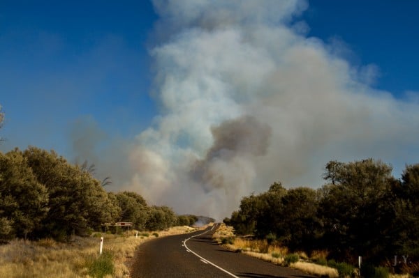
On the way to my first stop, the Redbank Gorge; I saw what I thought was a control burn. In fact, it was a bush fire starting up. I drove right pass the fire and see it burning away. Stopped at a lookout about 5km out and spoke to a guy who’s been camping there for 2 nights. He said he saw a little camp fire a couple of nights ago and the people probably didn’t put it out properly when they left. He saw the fire started to spread this morning due to the wind this morning.

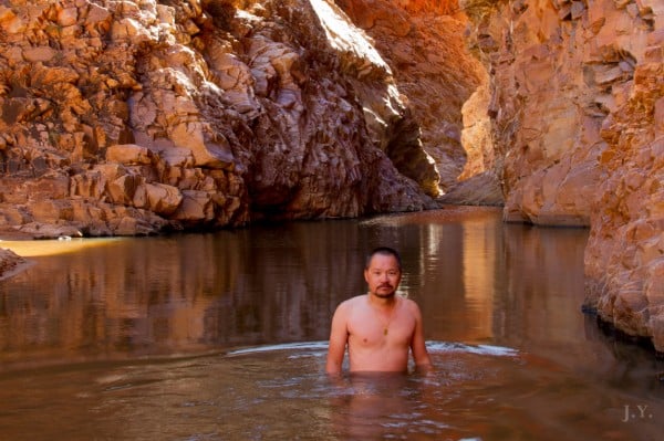
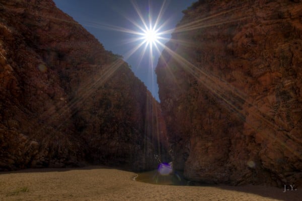
After chatted to the folk for a while, I went on to Redbank Gorge. It takes a 2km easy walk along the already dried river. Once you there, these sandstone walls are towering over you. In-between them, there is the gorge. I can tell you that the water was freezing because I went in for a swim. You can get a sense of how massive theses sandstones are from the second image, me dipping in the gorge, and the third image, the Redbank Gorge itself (That little bit of water near the bottom right hand corner is the pool I was dipping in). It was very breathtaking.

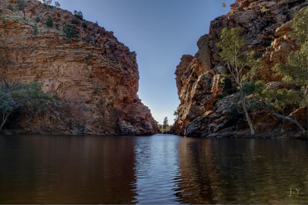
After spending about 1.5 hour at the gorge. My second and last destination was Ellery Creek Big Hole (the forth image). It was just as breathtaking as the Redbank As the name goes, the water pool is lot bigger than Redbank and you can swim in it as well. By the time I looked at the time, it was time to return to Alice. The time just seemed to disappear when being in places like these.

On the way back, the bush fire had worsen and I could hear helicopter was dumping water onto it. The fire made quite a devastation in a few short hours that I went by. Friends, I am sure you do already but do please make sure your camp fire is out before leaving the site when camping. πŸ™‚

John (stuck) @ Alice Springs, NT


Images: 1. Bush Fire; 2. Dipping in Redbank Gorge; 3. Redbank Gorge; 4. Ellery Creek Big Hole
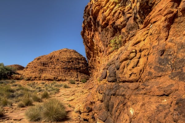
Dunes in Kings Canyon
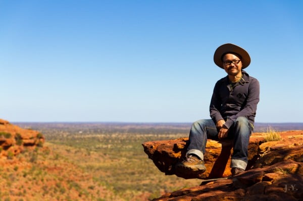
Me on Edge
Sun Burst
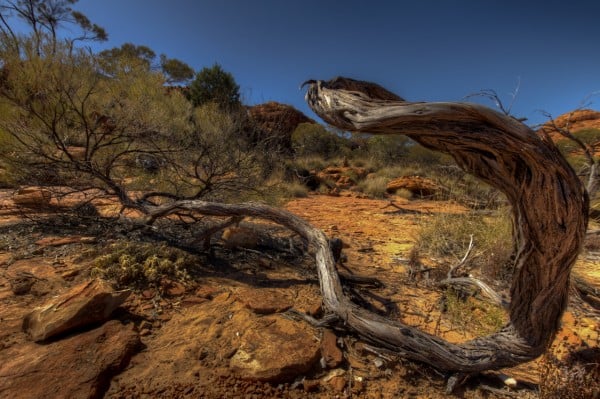
Survivor

Day 25: A Day of Rest

I’ve done nothing today… just wanted to have a rest from all the driving and hunting for photo opportunities. Instead, just wandered around the streets of Alice Springs. It was freezing this morning when I got up. I believe it was 1 degree or something like that. It warmed up as the sun went higher up in the sky.

I noticed today that one of the back tyres looking a bit flat and thought it would probably be a puncture from the rough road coming back from Kings Canyon last night. It was rough and little rocks were all over the road. I did think it would happened. Took the car into K-Mart Tyres here for a check-up and, sure thing, there was a puncture. They fixed the tyre and did a wheel alignment… hopefully this will be good for another 10000km.

In my free time today, looked at some of the places or tracks for my journey beyond Alice Springs. It looks like a lot of dirt road and no communications again. So you know I have no internet if you don’t see me posting in the coming days.

Time is 4:30pm and I am just having a rest in the car, sorting through some of the pictures taken yesterday (too many of them) and staring at the Desert Park in front of me. It is a peaceful and beautiful day in Alice indeed…

John @ Alice Springs, NT


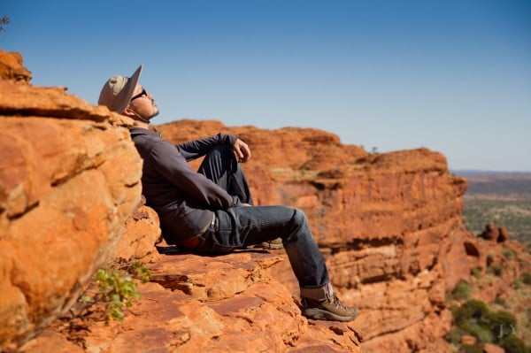
Images: 1. Rock Domes in Kings Canyon; 2. Me Sitting on the Edge; 3. I Love Sunburst; 4. Still Surviving
Kings Canyon
Me at Kings Canyon
Dusk at Kings Canyon

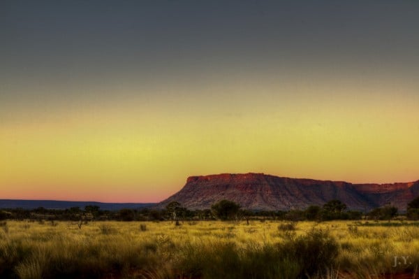
Day 24: Kings Canyon

It was the longest I have been out of communication since my trip. Kings Canyon is wonderful if you like hiking. I actually do like it and did a 5-hour hike today. Thats with the walking and taking hundreds of photos. I am literally exhausted by the time I hiked then drove all the way back to Alice Springs.

I could’ve stayed at Kings Canyon but thought since I done the Kings Canyon hike; that’s pretty much all there is to do. So decided to bite the bullet and get myself back to Alice so I can have a full day there.

Please excuse me if I keep this post short…really need to get some rest

-_-

John @ Alice Springs, NT


Images: 1. Stone Stack at Kings Canyon; 2. Self Portrait; 3. Dusk at Kings Canyon
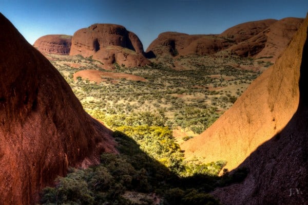
Valley of the Winds
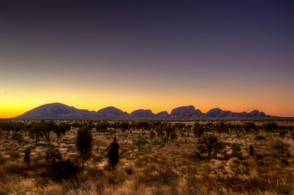
Sunset over Kata Tjuta

Day 23: Uluru and Kata Tjuta

Wow.. I love this place… it’s totally up my alley. I can easily spend a week or two here just doing all the tracks. Did one today and it’s called ‘Valley of the Winds’ in Kata Tjuta. I loved it. To be honest, I like Kata Tjuta better than Uluru because there are so much more landscape to see. It was quite spectacular. I made a little time lapse of it as well and will post it later on.

After the hike, came back to the camp ground and had a shower. Then went to supermarket bought myself some needed healthy food… lentils and chickpea salad + a punnet of cherry tomatoes. Took that to my planned destination for my last sunset shots attempt. As usual, took heaps just in case. I am going to be very busy when I get back to Sydney to process them properly. Some may even be good enough to print πŸ™‚

Tomorrow heading to Kings Canyon and that should be just as good if not better.

Luv y’all

John @ Uluru, NT


Images: 1. Second Lookout at Valley of the Winds; 2. Sun setting behind Kata Tjuta